Cave and Karst Science Logo

Volume 30(1), 2003

BCRA > Publications > Cave & Karst Science> Contents

Scroll down for Editorial | Papers | Reports | Forum | Thesis Abstracts

Front cover
  • Fossil Dinantian fish in Ogof Draenen, South Wales
  • A scallop dominant discharge for vadose conduits
  • Speleothem-like calcite and aragonite deposits
  • Dolomotization at Black Keld, Yorkshire, UK
  • Hydrodynamics of the Gilan Spring, Iran
  • Sub-sea level speleothems, Thailand
  • The Çamlik Caves System, Turkey
  • Forum

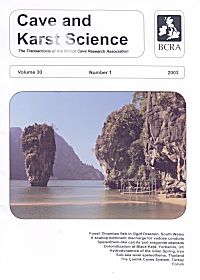
Cover photo by Dean Smart: Spectacular drowned tower karst off the Andaman Coast of southern Thailand has been used as a backdrop for many movie productions. The scenery shown here, for example, appeared in 'The Man with the Golden Gun'. These islands have evolved partly as a result of rising and falling sea levels, a topic that is the subject of a Report by Dean Smart in this Issue.

Editorial

(Gunn, J. & D. Lowe (eds))
Editorial
Vol 30 (1) p 2
Although this is the first issue of the 2003 Volume of Cave and Karst Science we send all our readers Christmas greetings and best wishes for 2004! This seems more positive than apologising for the fact that, yet again, and despite our best efforts, this issue has been unavoidably delayed. However, we are pleased to record that Volume 30 Number 2 is close to completion and should be with you very early in 2004. Graham Proudlove has kindly agreed to provide a Guest Editorial for that Issue, which includes the first major review of the subterranean aquatic Crustacea recorded in Britain and Ireland.

Delayed though it may be, we hope that readers will enjoy the present issue and as editors we are particularly pleased at the mix of papers presented. Authors from inside and outside of academia cover various aspects of earth science, hydrology and palaeontology, based on studies in Britain, Iran, the Mariana Islands, Thailand and Turkey.

As the 'merger' between BCRA and NCA to form a new BCA gradually proceeds, some thought is being given to the future of this publication, particularly in terms of content and format. As editors we feel that the present balance between the different aspects of cave and karst science, and the geographical coverage (as reflected in this issue) are about right. We also feel that by publishing both fully refereed scientific papers and less rigorously reviewed reports we provide an opportunity for both 'academic' and 'amateur' cave scientists to contribute. As always we welcome the views of readers as to how well we succeed and whether there are areas that we are not covering and where we should be actively soliciting papers. The format of the journal has also become well established and seems to work well, although again we would be interested to hear if there are any contrary views or suggestions for improvement.

More controversially, there have been some suggestions that the journal should not appear as hard copy but as electronic copy on the World Wide Web. A good example of an electronic journal, which readers with an interest in the earth sciences might wish to examine, is Speleogenesis, published jointly by the Commission on Karst Hydrogeology and Speleogenesis of the International Speleological Union and the IGU Karst Commission
( http://www.speleogenesis.info/). The journal publishes a mixture of 'new' articles, which are refereed by members of the Editorial Board, and 'old' articles, which have already been published elsewhere but are deemed to be worthy of drawing to the attention of a larger audience. The latter include a number of papers that were previously published in Cave and Karst Science. As the name implies, Speleogenesis focuses on the origin and development of dissolutional caves, although this is placed within the somewhat broader context of the hydrogeological setting and the evolution of karst. Although the web site is very professional, and provides useful information in addition to that in the actual papers, personally, both of us prefer our journals as hard copy. However, we recognise that the Web may provide opportunities for swifter, cheaper, publication, and these benefits are certainly worth pursuing.

Papers

(Charlton, R.A.)
Towards defining a scallop dominant discharge for vadose conduits:
some preliminary results

Vol 30 (1) pp 3 - 7
Abstract: A well-established inverse relationship exists between mean scallop length and flow velocity for a given population of scallops. Previous authors have suggested that one or more 'scallop dominant discharges' can be identified at which erosion by dissolution proceeds at the greatest rate, since scallop populations usually indicate a single flow velocity whereas discharge and velocity are unsteady through time. For vadose conduits, a scallop dominant discharge is difficult to define because of the unconstrained cross-section; this causes problems in determining the discharge at which scallops are formed, although recent developments in instrumentation allow greater flexibility in monitoring flows on a continuous basis. Here the relationships between monitored flow velocity and depth are compared with the scallop velocity for an active vadose streamway in Poulnagollum, Co. Clare, Ireland. From these initial results, a complex relationship is seen to exist between the velocity and depth of flow as discharge changes. Thresholds occur over discrete depth ranges where there is little or no change in velocity; these are observed during both rising and falling stage. It is suggested that these thresholds may be related to changes in hydraulic radius, and hence flow resistance at different depths of flow. The scallop-derived velocity is related to the recorded flow data, with reference to the various controls on erosion, most notably the degree to which the flow is undersaturated with CaCO3, and ongoing research is outlined.
(Dogan, U. & L. Nazik)
The Çamlik Caves System (Konya, Turkey)
Vol 30 (1) pp 9 - 14
Abstract: Çamlik Caves are an active and semi active cave system located in the Western Taurus in Çamlik town, south of Beysehir Lake. The caves were enlarged when a palaeo river (a palaeo tributary of the Manavgat River), flowing on a Pliocene denudational surface in Late Pliocene to Early Pleistocene times met a northwest-southeast fault line, incised deeply and integrated into a pre-existing underground water system. During the Early Pleistocene the system, which now comprises Körükini and Suluin caves, was a single unit. A collapse doline formed where the Pliocene palaeo valley intersected an existing conduit, resulting in ceiling collapse, and the original cave was divided into the two parts. The system was unable to extend deeper because the limestones were not very thick and the base comprised insoluble formations. Because a sinking river developed the cave system it displays single conduit cave features and a sinuous passage. The cross-section of the cave is of elliptical, canyon type, reflecting the guidance of the fault line and the effects of hydraulic control.
(Karimi, H., E. Raeisi & M. Zare)
Hydrodynamic behavior of the Gilan karst spring, west of Zagros, Iran
Vol 30 (1) pp 15 - 22
Abstract: The Gilan aquifer is located in the southwest of Kermanshah, west of Iran. This aquifer discharges through the Gilan Spring, with an average discharge rate of 938 1/s. The catchment area of the Gilan Spring was determined using hydrogeological approaches. Electrical conductivity (EC), water temperature, pH, major ions and discharge were measured at two-weekly intervals within the period of September 2000 to September 2002. Water temperature, EC, and stage were measured once every two days in the wet season. Calcite, dolomite and gypsum saturation indices and partial pressures of CO2 were calculated using the WATEQF hydrochemical model. The hydrochemical data, percentages of base flow and recession coefficients imply that the type of flow is mainly diffuse in the Gilan aquifer. The EC time Series of the Gilan Spring implies that a high percentage of the spring water is supplied by conduit flow. The peak discharge occurs when conduit water in the part of the aquifer near the spring provides the Gilan Spring discharge, whereas conduit water from more distant parts of the aquifer reaches the spring during recession periods. The contribution of conduit flow during dry periods reduces the variations of physico-chemical parameters and produces a low value of recession coefficient. This kind of behaviour occurs in aquifers with a long and narrow catchment area, in which rain duration is significantly less than the time lag so that the EC decreases during dry periods.
(Taborosi, D., K. Hirakawa & K. Stafford)
Speleothem-like calcite and aragonite deposits on a tropical carbonate coast
Vol 30 (1) pp 23 - 32
Abstract: Vadose precipitation of calcite and aragonite can occur in marine notches and similar coastal overhangs in the tropics. The resultant deposits are reminiscent of speleothems and have been termed "littoral dripstone" and "littoral flowstone." They lack the luster and crystallinity of cave analogues, and are composed of highly porous layered microcrystalline calcite and aragonite, commonly containing inclusions of calcareous grains of marine origin. These deposits appear to be a distinct coastal variety of tufaceous stalactites reported from entrances of tropical caves. Aside from providing valuable insights into the previously unrecognized carbonate precipitation in the modern supratidal zone on tropical coasts, these deposits are of practical interest to geomorphologists. If not recognized as not being true speleothems, they can cause misinterpretation of wave cut or bioeroded landforms as remnants of solution cavities.

Reports

(Kendall, A.J. & R.S. Hicks)
Dinantian vertebrate (fish) remains in the walls of Ogof Draenen, South Wales, UK
Vol 30 (1) pp 33 - 36
Introduction: Unusually well preserved, and preferentially eroded, vertebrate remains have been recorded in many sites in the walls of Ogof Draenen (NGR SO 2463 1178), South Wales. These have previously been reported in the briefest of details only. They are described more fully here, with some consideration of their palaeontological and stratigraphical significance, and their relationships to some passage names within the cave. Brief descriptions of the fish taxa and morphology are also provided. The nature of the preservation of the fossils, and their location within the cave, may provide valuable indicators of water flow regime during the formation of the passages in which the fossils have been found. This document also forms a permanent record of some sampling from the cave.
(Murphy, P.J.)
Dolomotization of the Great Scar Limestone Group in the Black Keld catchment, North Yorkshire, UK
Vol 30 (1) pp 37 - 38
Introduction: Black Keld is the rising for water sinking on an l8km2 area of moorland on the east side of Wharfedale including drainage from Langcliffe Pot (9.6Km long, 116m deep) and Mossdale Caverns (10Km long, 60m deep). Diving exploration began in the 1949, when divers reached an underwater pot 50m from the entrance. At the limit of the exploration the passage walls were observed to change from smooth to "...being corroded to a fantastic three dimensional maze". Progress beyond this point was made in the late 1960s and early 1970s, when a further 100m of passage was explored. This passage is unlike that explored in 1949, being much smaller, and the diver has to manoeuvre between interleaved fingers of friable rock. The friable nature of the rock in this region led to some divers describing the area as a boulder choke. The way on was lost 150m from the entrance.
(Smart, D.)
Sub-sea level speleothems from the Andaman coast of southern Thailand, and sea level change in Southeast Asia
Vol 30 (1) pp 39 - 42
Abstract: Recent exploration of a freshwater, vauclusian spring near the Andaman coast of southern Thailand has discovered submerged, calcite speleothems of sub-aerial origin. These occur between depths of -15m and -90m, equating to 0m to 75m below mean sea level (b.m.s.l.). A sample from -59m (= 44m b.m.s.l.) has been dated using radiocarbon and found to be 34.2 ± 4.5Ka old, implying that the spring was dry at least to this depth at this time. This situation arose as a result of deeper water rest levels in response to a relatively lower sea level.

Forum

Correspondence: Bregani, R., Energy Replenishers (Gibson, A.D., with reply by the author)
Vol 30 (1) pp 43 - 44
Correspondence: Pringle, J. et al., Peak Cavern (Ford, T.D., with reply by the authors)
Vol 30 (1) pp 44 - 45
Correspondence: Craven, S.A., The depth of Gaping Gill (Murphy, P. & S. Allshorn)
Vol 30 (1) p 46
Abstracts from Karstologia for 2002 (Authors)
Vol 30 (1) pp 47 - 48

This page created by Dr John D. Wilcock


button Top of Page